
Well, I survived the Pemi Loop. Why not take on another notorious trail?
The 24 miles of Devil’s Path are infamous among hiker circles, often making lists for the most physically challenging hikes in the U.S., and apparently racking up its share of casualties. But I already knew the Catskills. I knew the near-vertical climbs and the rocks and scarce water sources among bafflingly wet trails. And I had just done the Pemi Loop. If that didn’t beat me down, what would?
Spoiler alert: not Devil’s Path. I chewed that thing up and asked for more.
- Map: NYNJTC Northeastern Catskills Trails Map 41, 11th edition
- Miles: 24.4 Devil’s Path miles, 30.2 total miles
- Days: 3
- Peaks bagged: Indian Head (3573′), Twin (3640′), Sugarloaf (3800′), Plateau (3840′), Hunter (4040′), Southwest Hunter (3740′), West Kill (3880′)
- Camps: stealth site on Plateau Mountain, Diamond Notch Lean-To tenting area
- Notable critters: black-throated blue warblers, black-throated green warbler (or another yellow-ish warbler with a black throat), barred owl, small-ish brown hawk (red shouldered maybe?), possible raven, possible great horned owl screaming. And way too many blue jays.
DAY 1: Prediger Road trailhead to mostly up Plateau Mountain (9.25 miles)
I used the Catskills Trail Conditions Facebook group to arrange a shuttle with a guy and his dad who were driving up from Long Island. We met at the end of the trail on Saturday morning, I parked my car, and I got a lift from them to the trailhead at Prediger Road. On the last day, the three of us would drive back to their car at the beginning, and we’d part ways. “You’ll probably pass me on the trail somewhere,” I said as they stretched themselves out, and I took off by myself to follow the red trail markers for the next three days.

And immediately blew past my first water stop. Whoops. I realized my mistake when I reached a trail junction 1.65 miles in. I wouldn’t see water until Mink Hollow Shelter at the end of the day, and I had to go over Indian Head Mountain, Twin Mountain, and Sugarloaf Mountain before that. But I was too lazy to add another half-mile to my day by going down the junction to a legit water source, so I scooped up some trail runoff and filtered that stuff while trying not to think of how gross it was.
The views weren’t great, but I wasn’t expecting to see anything spectacular as I made my way up Indian Head, four miles in. This was the Catskills, and more specifically, Devil’s Path, a supposed onslaught of ups and downs with no views to reward your effort.


What I did see? Was rocks. Piles and piles of rocks. Par for the course for the Catksills, really. As I pulled myself up the vertical rocks, I was reminded of the tough hikes over Slide-Cornell-Wittenberg and Black Dome Range Trail. But I had somehow expected more rocks and more elevation change. Websites and guidebooks told me over and over again that Devil’s Path would be nonstop elevation changes, but my Catskills hikes last year felt worse. I was almost disappointed when I found multiple patches of level ground. Maybe I have a more flexible definition of “level”?

As I hiked, I compared the rocks here to the ones in Pennsylvania, Vermont, New Hampshire. Catskills rocks are more vertical, as you can see above. Layers of rock peel off in vertical and horizontal sheets. Pennsylvania offers you boulder fields that will chew your feet up. New Hampshire and northern Vermont give you granite and who-knows-what in various configurations, sometimes pointy boulders, sometimes wet steep slabs, sometimes just smaller annoying rocks everywhere.
I’m experienced enough now that I’ve developed a sort of hiking vocabulary. I can compare this pain to that pain, this incline to that incline. My muscles were tired when I reached the junction with Mink Hollow Shelter well before 4pm, but they were NOTHING like the day I went up and then down Mt. Mansfield, the highest peak in Vermont, then dragged myself halfway up Smuggler’s Notch, while in constant pain from a nerve affliction. When I decided to hike past Mink Hollow and see how far I could get by 5pm – a “normal” time in my vocabulary – the steep incline up Plateau Mountain wasn’t as bad as that incline up Smuggler’s Notch last year. When I didn’t have a site by 5pm and needed to keep going for a few minutes, surrounded by spongy steep ground and fallen trees, I wasn’t filled with that sense of dread and urgency I’d felt in my gut on the Long Trail when I’d had to set up camp in bad sites as the sun set.
Right below the sign reading “3500 feet – no camping above this point,” I found a somewhat level site on a grassy little plateau, invisible from the trail due to the mist. I even had cell phone reception!
Later I’d find out I was one of the only folks who didn’t get ticketed for my site. Rangers checked the established yet technically illegal sites at the top of Plateau (they’re above 3500 feet where the vegetation is more fragile, and a few feet off the trail instead of 150 feet away), and they ticketed campers at Mink Hollow Shelter who couldn’t find a space in the overfilled camping section and set up their beyond the “No camping” markers. I figured the Saturday of Labor Day Weekend would be busy, so as I heard from one hiker after another about their tickets, I thanked my legs for being awesome and my hammock system for being so dang flexible.
DAY 2: Plateau to Diamond Notch Falls Shelter (8.6 miles), plus side trips to Hunter Mountain and Southwest Hunter Mountain (3.3 and 1.5 miles, for 13.4 total miles)


Plateau Mountain was very pleasant in the manner of spongy, conifer-filled, higher elevation parts of the Catskills are, and was basically flat for two miles (as the name might imply). I descended, ascended, wondered when I’d see some fun rocks instead of the little annoying ones, wondered if I’d get any sort of view now that the fog was starting to burn off, wondered if I’d see pines again, and was caught by surprise when I hit a crucial trail junction at 11:40 am. I was less than 3 miles from my shelter, which I would reach before 2:30 if I kept up my pace. Way before my 4:30 minimum. That would not do.
But I had a plan. Devil’s Path on its own would allow me to cross five of the 35 Catskills 3500’+ peaks off my list, but I could cross off two more with a couple side excursions. From the junction, the flattish 1.65-mile trail to Hunter Mountain took me through nice pines I hadn’t seen since morning, and to a well-maintained clearing with a caretaker cabin and a fire tower.


Hunter Mountain: done.
Next up was my first “bushwhack” of the Catskills 35: Southwest Hunter, also known as Leavitt Peak. Many peaks of the Catskills 35 don’t have maintained or marked trails to the summit, but enough people traverse them that there’s an unofficial path. I studied my maps and saw I’d be walking on a plateau with a dropoff on my right side, so it should be easy to find the little path. Just in case, I put out a buoy – I turned on my GPS and started a hike on MapMyRun so I could track my path to make sure I was following the contours, and so I could easily find my way back if I got lost.

I somehow missed the cairn that marked the start of the path, but I found the narrow trail soon enough. I had no idea how long this path would be. A mile? More?

Three-quarters of a mile later, I came to a clearing with a grey-painted wooden box hanging off a tree. This, I guessed, was the summit. No views, of course. I turned around and headed down the trail to Diamond Notch Falls, and even though I’d added 4.8 miles to my day with these two peaks, I still had time for a creek bath. I’d earned it.

I would have loved to stay closer to the creek, but the mosquitoes and ubiquitous horrible stinging plants – wood-nettle, apparently, which I found out the hard way feels like a low-grade bee sting – drove me the half-mile uphill to the shelter. At the shelter, two barking dogs drove me to a stealth spot downhill that was slightly buggy but quiet. I had set up my hammock and changed into my night clothes and was boiling water for Minute Rice when I realized the mosquito situation had gone from “tolerable” to “merciless and constant like that terrible weekend by Nuclear Lake.” I changed back into sweaty hiking clothes and haphazardly threw everything in my bag, perching my soaking dinner carefully on top, for the five-minute hike back to the shelter and the tent sites nearby.
You might think this will end badly… well, it won’t. The dogs were quiet, I found a great spot among some pines, I managed to not spill my food, and who should come hiking up as I sat happily rocking and eating my rice, but my shuttle guys from the day before! Like most overnight folks I saw that weekend, Devil’s Path was giving them quite a challenge but they were sticking it out. I was happy to see they were pushing to the end, and I’m sure they were happy to see their ride back to their car. We talked gear and trails and heard an owl of some sort, and possibly ravens.
DAY 3: Diamond Notch Shelter to Spruceton Rd (7.55 miles)
I finally got a view on West Kill Mountain!


I sunned myself on the rock for a few minutes, but I didn’t stay too long. The terrain of the trail had evened out, and there would be no more high-elevation pretty areas or other points of interest for the remaining few miles of the trail. I always grow impatient on the last day of these trips.
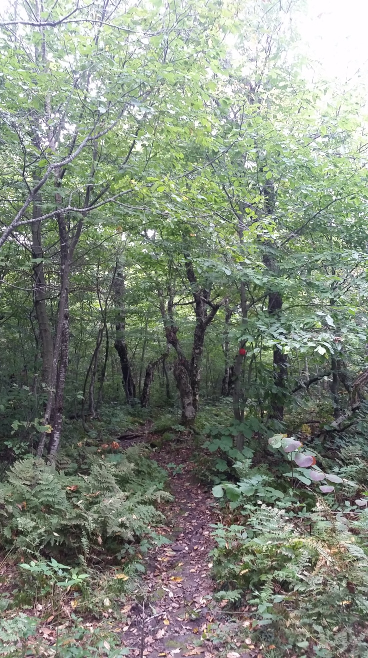
Pretty enough. But no dramatic rock formations, no pines, no views, and most importantly, no egg salad sandwiches.
When I thought I was nearly done, I came to a sign that told me the parking lot was 1.55 miles away. I nearly had to run through the boggy area ahead to avoid the onslaught of mosquitoes, but one false move would give me a sting from my new friends the wood-nettles.

Remember how in Game of Thrones they have those dramatic shots of the army of the dead and how it goes on for miles and miles? That’s what those wood-nettles are like. Just looking at them makes my skin crawl at the remembrance of that sting. You know the kind, the hot-then-cold that goes all through your body.
Add in the obnoxious blue jays that would hang around screeching, even when I started screeching back at them, “Mleh, I’m a blue jay! I’m annoying, so pay attention to me!” and it became clear to me that Devil’s Path may not have been physically challenging, but the mental challenges were there. That’s all of the Catskills, though: little things that seem almost designed to drive you slowly mad.
But within a few hours, I was finished! And I never have to do it again if I choose not to. However, there was that brewery right down the road…

Leave a comment